Everybody was talking today about Obama's approval rating,
or rather, the disapproval rating of 79%.
Most of us hope that this continues towards the polls.
We all have been wondering where our California governor is
as after the election he just seemed to disappear. He was on news yesterday getting ready to
sign the California dream act, which allows illegal aliens to get
state-sponsored tax dollars for their tuition.
So we all noted that he in fact showed up on TV for this epic event.
We also discussed how the insurance companies will be
raising, collectively almost like a conspiracy, our flood insurance across the
nation. One of the members got a notice
of a $200 increase per year on a $400 per year insurance policy now, and that
is pretty outrageous. Most of those who
have mortgages have signed papers that we will continue to keep our flood
insurance, etc., current and now it seems the insurance companies can do
whatever they want. We can shop around
as long as they are all on the same page, you will do us no good. Our threat or risk of flooding has not
changed and should not warrant an increase in fees. Thoughts?
I asked for some wire to repair the Palapa on the beach as I
have some palm fronds to add. We
discussed what type of wire I would need and I also said due to my limited
income these days any donations of wire would be appreciated as I will not go
out and spend money on this project.
We had a very interesting discussion on guns in Canada. Phil discussed how he had to get completely
licensed to travel across Canada to Alaska with a shotgun. It's far worse if you have a handgun, as I
believe they are not allowed at all.
It's amazing what other countries gun laws are really like and I know
that Canada is more liberal than conservative and thus their laws reflect their
political nature.
We also discussed how, in plane crashes, everyone searches
for the black box first.
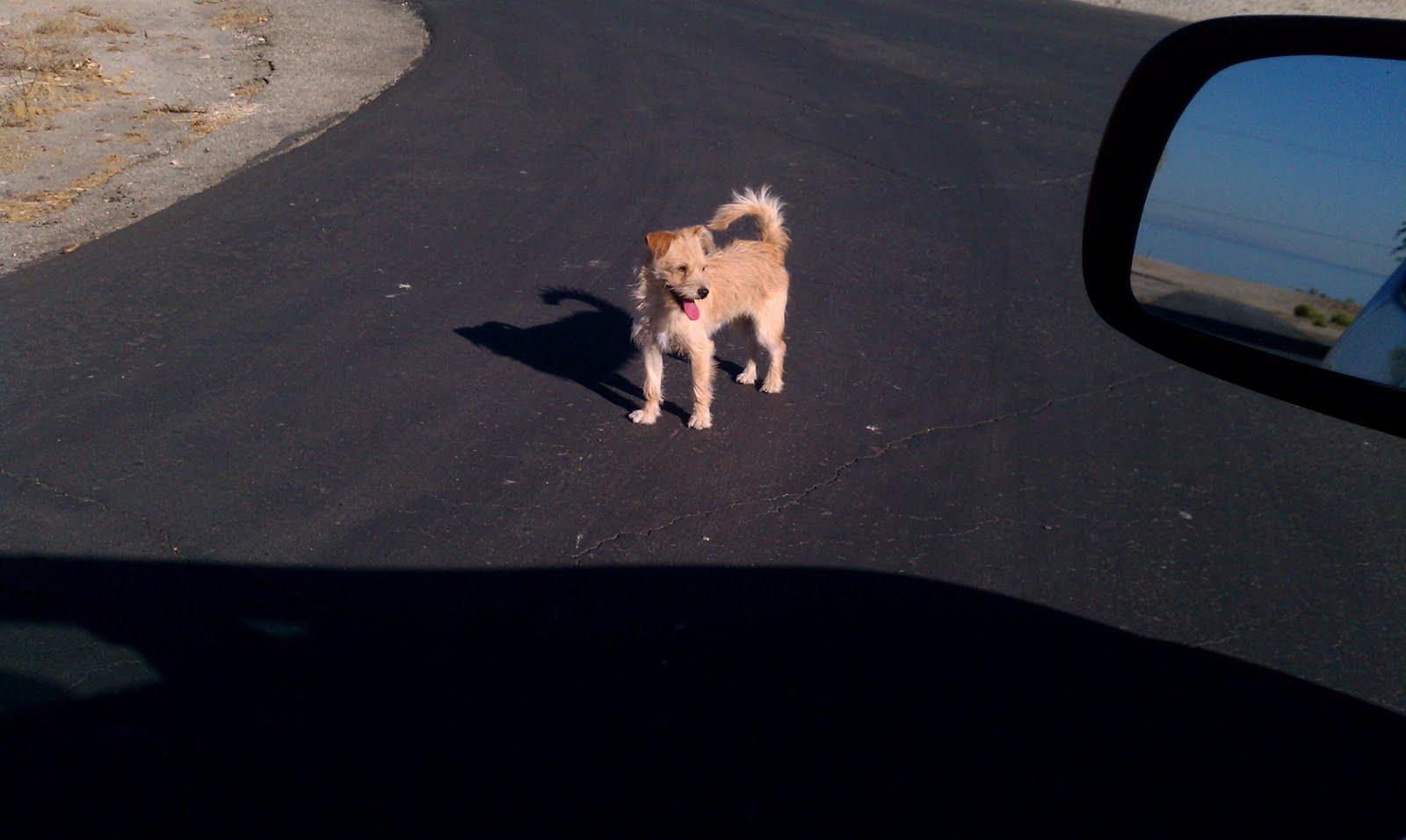
The dogs out here are way out of control (look down the street at them) and are now trying
to bite us as we take walks at night. I
was just out on the beach where we have our first fish die off, which I will
have pictures here momentarily, and the dogs barked at me in one particular was
very aggressive. Phil is going to try to
contact the dog catchers again today and see if we can get some resolution to
the five dogs that are now the pack in our community. Based on our previous community meeting with
the dog catchers I do not believe there will be any resolution at all and one
of us is going to get bit sooner or later.
Why these dogs are allowed to run freely, I do not understand, other
than we are not a contract city and therefore we have no dog catchers to help
us.
We also had our first fish die off that I have seen this year...
We also talked about Lucerne Valley, and Dick was discussing
an old story about Lucerne Valley, and I did not know where it was so I will
add some information from the Internet here on Lucerne Valley.
Lucerne Valley, California
Geography
Lucerne Valley is located 19 miles east of
Apple Valley and 20 miles downhill north
of
Big Bear in the southern reaches of the
Mojave
Desert. It is surrounded by several mountain ranges which include the
Granite mountain range, the Ord mountain range, and the San Bernardino mountain
range. The heart of Lucerne Valley is located on the crossroads of
State Route 247 (Old Woman Springs Road
/ Barstow Road) and
State Route 18.
Yucca
Valley lies 45 miles east via Route 247/Old Woman Springs Road.
In San Bernardino County, Lucerne Valley's area is also identified as County
Service Area 29.
According to the
United States Census Bureau, the CDP
covers an area of 105.6 square miles (273.5 km²), all of it land.
History
Lucerne Valley was known to local
Piute,
Chemehuevi,
and
Serrano Tribes
as "Chimney Rock", which is a California Historical Site of Interest;
On
February
1, 1867, Chimney Rock was the last major battle between California settlers
and Native Americans. A monument marker is present on the western edge of
Highway 18 at the western entrance to the town.
[4][original research?]
Lucerne Valley was settled and named in 1897 by James Goulding and his
family,
[5][self-published
source?] who found the desert valley to be an excellent place to
raise
alfalfa,
also known as lucerne. The closest water source at the time was Cushenbury
Springs (currently a cement plant in the southeast of the area) which used to
feed out by alluvial drainage after winter from the San Bernardino Mountains.
[citation needed] The waterflow
for the entire valley is fed this way through underground Artesian wells.
[6][self-published
source?]
Today, Lucerne Valley is an agricultural/mining-based community, with
Mitsubishi Cement, Specialty Minerals (formerly Pfizer), and OMYA (formerly
Pluess-Staufer) as its major contractors digging into the North Face of the San
Bernardino Mountain Range.
[citation needed] Lucerne Valley
also has a state-sponsored water reclamation project, where treated wastewater
from
Big Bear and
Holcomb
Valley is transported via pipeline and used to irrigate alfalfa farms on
the eastern edge of the valley.
One of the roads east of the town limit, Meridian Road, is the geographical
"Median" of
San Bernardino County dividing the area of
the county into west and east.
[citati
Recent development
While the town still has major obstacles preventing
incorporation in the near future, the town is still viable for possible
development.
[why?] One earlier attempt called
"Rancho Lucerne" began grading north of the High School location
before embezzlement charges filed against the financier caused the project to
shut down in 2001.
[why?][7][self-published
source?] Other projects are meeting with mixed reactions from
residents and state/county officials, including Solar Power and Wind Turbine
plants
[8]
as well as
Water Drilling proposals for the Los Angeles'
centric
Department of
Water and Power, who recently cancelled an attempt to install a 2 mile wide
water and power corridor in the Southern half of the town to transport distant
resources into Los Angeles.
[9]
Demographics
The
2010 United States Census[10]
reported that Lucerne Valley had a population of 5,811. The
population density was 55.0 people per square
mile (21.2/km²). The racial makeup of Lucerne Valley was 4,507 (77.6%)
White, 170 (2.9%)
African American, 106 (1.8%)
Native American, 90 (1.5%)
Asian, 0 (0.0%)
Pacific Islander, 676 (11.6%) from
other races, and 262 (4.5%) from two or
more races.
Hispanic or
Latino of any race were 1,447 persons (24.9%).
The Census reported that 5,780 people (99.5% of the population) lived in
households, 31 (0.5%) lived in non-institutionalized group quarters, and 0 (0%)
were institutionalized.
There were 2,176 households, out of which 685 (31.5%) had children under the
age of 18 living in them, 954 (43.8%) were
opposite-sex
married couples living together, 280 (12.9%) had a female householder with
no husband present, 157 (7.2%) had a male householder with no wife present.
There were 146 (6.7%)
unmarried opposite-sex partnerships, and 14 (0.6%)
same-sex married couples or partnerships. 632
households (29.0%) were made up of individuals and 255 (11.7%) had someone
living alone who was 65 years of age or older. The average household size was
2.66. There were 1,391
families (63.9% of all households); the
average family size was 3.28.
The population was spread out with 1,424 people (24.5%) under the age of 18,
452 people (7.8%) aged 18 to 24, 1,214 people (20.9%) aged 25 to 44, 1,780
people (30.6%) aged 45 to 64, and 941 people (16.2%) who were 65 years of age
or older. The median age was 42.7 years. For every 100 females there were 106.1
males. For every 100 females age 18 and over, there were 105.4 males.
There were 2,949 housing units at an average density of 27.9 per square mile
(10.8/km²), of which 1,454 (66.8%) were owner-occupied, and 722 (33.2%) were
occupied by renters. The homeowner vacancy rate was 4.3%; the rental vacancy
rate was 9.0%. 3,800 people (65.4% of the population) lived in owner-occupied
housing units and 1,980 people (34.1%) lived in rental housing units.
Public Safety
Sites of interest:
- Johnson Valley to the east of Lucerne
Valley is a popular off-road vehicle recreation site known for its steep,
rocky mountains and several dry lakes. Recent expansion plans for the
Twentynine Palms Ground Combat center from the United States Marine Corps
threatens to close the area permanently.[11]
- Lucerne Valley's two dry lakes, Lucerne Dry Lake and
Rabbit Springs Dry Lake are used for various activities.
- The Dry Lakes are used frequently in filming projects,
notably Rabbit Springs Dry Lake which was the scene for the attack
sequence in Stagecoach filmed in 1938. Selena
Gomez recently shot her music video A Year Without Rain in Rabbit Springs Dry
Lake during Summer 2010.
- Lucerne Dry Lake is also licensed for used by the County of San Bernardino as a
testing ground for Firework displays planned by private companies due to
the low amounts of vegetation within the lake bed that could spark from a
misfire.[citation needed]
- Chimney Rock, a registered landmark
of the State of California, is located on the mountains north of Highway
18 at the Rabbit Springs Road junction.[why?] An official landmark
is at Highway 18 next to the welcome sign at the western border of town.
- The Box-S Ranch chimney ruin is located opposite of the
junction of Highland Road and Highway 18 next to a drainage wash. It is
the last remaining structure of the Box-S Ranch complex built by James
Goulding.[why?]
- Amateur mining claims in the surrounding hills are
present throughout the geographic region of Lucerne Valley where mainly quartz, topaz and jasper can be
found.[citation needed]
Notables
- Jordan Romero, former resident who is currently
the youngest person to climb Mt. Everest.[12]
- Thora Birch, actress.
- Harry Abdul, father of Paula
Abdul, who started a bottled water company called Crystal Hills in
1996 based in Lucerne Valley's foothills. (The company was sold to a
private firm and closed in 2005.)